The fastest way up to Daecheongbong, Seoraksan’s summit, is the Osaek course. But don’t let “shortest” fool you into thinking it’s easy. The reason it’s short is exactly why it’s brutally steep.
I’m basing this recommendation on a hike I did myself in the dead of winter, on a day when snow was piled up past my shins. Climbing straight up to Daecheongbong and straight back down feels like a waste of the effort you put in, so I’ll walk you through the course that goes up via Osaek, takes in the view of the East Sea from the summit, and then descends toward Hangyeryeong Rest Area instead. The ridge leading down to Hangyeryeong is genuinely stunning.
In this post, I’ll cover the Osaek-to-Hangyeryeong route on Seoraksan, what to pack for a winter hike, how to get to Osaek Trail Support Center, and where to eat after coming down.
Distance and Difficulty: Osaek to Daecheongbong to Hangyeryeong Rest Area
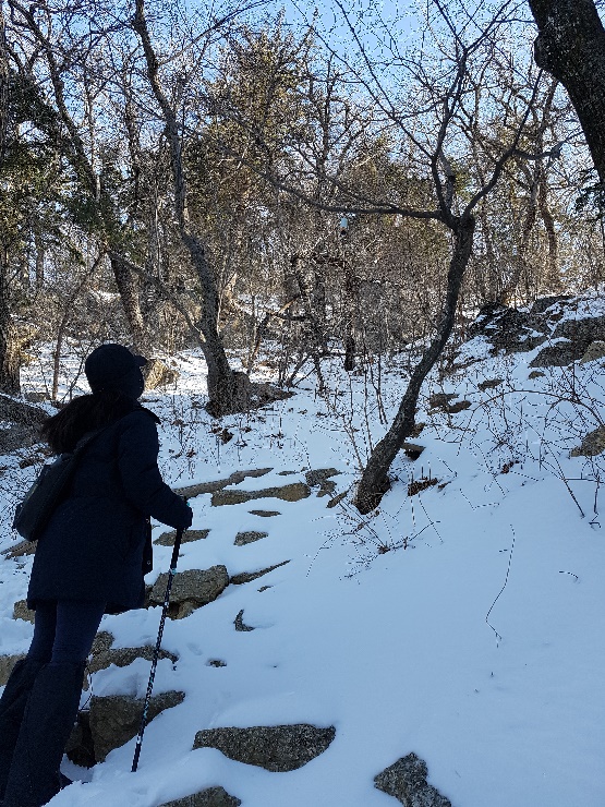
The route from Osaek Trail Support Center to Daecheongbong covers 5km, the shortest of any route to the summit on Seoraksan. But short doesn’t mean easy. Osaek Trail Support Center sits at 450 meters elevation, and Daecheongbong is 1,708 meters, which means you’re climbing 1,258 meters of elevation gain in just 5km. According to the Seoraksan National Park office’s own guidance, this stretch is classified as a notoriously tough one-way climb, officially estimated at 4 hours. I did this section in winter myself, on a day when snow was piled up past my shins, and it took considerably longer than that estimate. The endless stairs and steep rocky path meant there were more than a few stretches where I was gasping for breath.
Source : Korea National Park Service
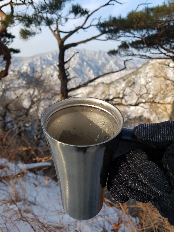
Reaching the summit makes all of that effort worth it in an instant. On a clear day, you can see all the way out to the East Sea, and in winter, that view comes with a blanket of pure white snow on top, which makes it an even more spectacular sight. You could head straight back down to Osaek from the summit, but I’d recommend turning toward Hangyeryeong instead. The ridge trail from Daecheongbong through Jungcheong and Kkeutcheong, down to Hangyeryeong Junction and on to Hangyeryeong Rest Area, is one of the most scenic stretches anywhere on Seoraksan. The full distance from Osaek to Hangyeryeong comes out to roughly 16km, and you should budget around 7 hours at a comfortable pace.
There’s one important thing to know before you go. Jungcheong Shelter, located just below Jungcheong Peak, is currently closed as of this writing (October 2026) due to demolition and reconstruction work, and there’s no confirmed date for when it will reopen. Check the latest notices on the Korea National Park Service’s reservation system for updates. The Osaek-to-Hangyeryeong route can be completed in a single day, so staying overnight at a shelter isn’t strictly necessary for this course, but if you’re planning to connect it with a longer traverse, this is something you’ll absolutely want to confirm in advance.
Source : Korea National Park Service
What to Pack for a Winter Hike (Korea Mountain Essentials)
Regular hiking gear isn’t enough for Seoraksan in winter. From my own experience, the two most important items are crampons and gaiters.
Source : Ministry of Environment
Crampons are essential for keeping your footing on snow- and ice-covered stairs and rocky paths. The first time I hiked Seoraksan in winter without crampons, I nearly took a bad fall partway through the Osaek section when my foot slipped out from under me. I haven’t hiked in winter without them since. Gaiters keep snow from getting into the tops of your boots. On the day I hiked with shin-deep snow and no gaiters, my socks ended up soaked through, and it made for a miserable rest of the hike. Since then, checking my gaiters the night before a winter hike has become a non-negotiable part of my routine.


Beyond those two, I’d recommend bringing warm gloves, a windproof jacket, and spare socks as a baseline. Conditions near Daecheongbong can drop below 10 degrees Celsius even in midsummer, so in winter, the wind chill regularly approaches minus 20 degrees Celsius. Make sure to pack a thermos of hot water and emergency food as well.
Seoraksan has also seen tragic cases where a sudden temperature drop and rain in early autumn led to hikers losing their lives, including a man in his early thirties. It’s genuinely not a mountain to take lightly, so please make sure your cold-weather gear is as thorough as it can be.
Getting to Osaek Trail Support Center
Here’s how to get to Osaek Trail Support Center from Seoul, covering both public transit and driving.
If you’re using public transit, you can take an intercity bus from Dong Seoul Bus Terminal to Osaek Bus Terminal. From there, Osaek Trail Support Center is within walking distance. That said, if you’re planning an early pre-dawn start, keep in mind that there aren’t many buses running at that hour. You can check the current schedule on the Korea National Park Service website (knps.or.kr), under the Seoraksan National Park visitor information section, and book through a bus reservation app.
If you’re driving, take the Seoul-Yangyang Expressway toward Yangyang, then exit onto the national road heading toward Osaek. Since this expressway opened, the drive from Seoul to Yangyang takes roughly 1 hour 30 minutes under normal conditions, though weekends and peak season traffic can add significantly more time, so it’s worth leaving earlier than you think you need to. There’s a parking area near Osaek Trail Support Center, but spots fill up quickly during fall foliage season and winter weekends, so arriving early is a good idea.
Source : Korea Expressway Corporation
Where to Stay
Seoraksan is a big enough mountain, and this course long enough, that I’d recommend staying overnight nearby rather than attempting a round trip from Seoul in a single day. I tried the day-trip approach myself once, and ended up rushing through the entire hike because I was watching the clock the whole time. I’ve booked a place to stay the night before ever since.
For where to stay, I’d recommend either near Jumunjin Beach or near Sokcho Jungang Market. Jumunjin is a quieter spot right on the coast, and it’s still an easy distance from there to an early-morning start at Osaek or Hangyeryeong. Sokcho Jungang Market has better access overall, and it’s convenient if you want to head straight into the market for dinner after coming down from your hike. Both areas have plenty of lodging options, so pick based on your budget and the kind of atmosphere you’re after.
Where to Eat After Your Hike
Rather than pointing you to one specific restaurant, I’d suggest basing yourself near Jumunjin or Sokcho Jungang Market and simply diving into the neighborhood itself. Jumunjin is known for fresh raw fish and seafood straight from the market, and there’s no better reward for a body worn out from hiking than a spread of fresh seafood. If you’re near Sokcho Jungang Market, walk the market alleys and start with street food like dakgangjeong (Korean fried chicken), sundae (Korean blood sausage), and squid sundae, then sit down at whichever stall or restaurant catches your eye and try the kind of traditional Korean food locals actually eat. I’d argue that wandering and eating your way through the market atmosphere itself makes for a more memorable experience than chasing down one specific “must-visit” restaurant.
Recommended Reading
Korea Mountain Hiking Guide : Taebaeksan’s Yuilsa Course
Korea Hiking Guide : Wolchulsan, Jeonnam Yeongam’s Sunrise Hotspot
Korea Mountain Hiking Guide : Geoje Mangsan
Best Korea Mountain for Fall Foliage : Sobaeksan Hiking Course and Local Food Guide
Korea Mountain Hiking : Bukhansan Course from Jeongneung to Baegundae Peak