About 70 percent of South Korea’s land is mountainous. There’s a running joke that half the country’s population are outdoor enthusiasts because of it. It’s also part of why international outdoor brands love the Korean market so much: middle-aged and older Korean men treat outdoor gear almost like everyday work clothes. Korea takes its outdoor culture seriously, in other words.
Even with mountains covering 70 percent of the land, Korea doesn’t have the towering peaks you’d find in China, the US, or South America. What it does have is stunning scenery and well-maintained trails managed by the national park system. On the larger mountains, the national parks also run mountain shelters (located deep in the high country) where an overnight stay is surprisingly cheap. If you’re ever going to try hiking in Korea, it’s worth experiencing at least once.
I’ll be sharing a lot of Korean hiking information on this blog going forward. For this first post, I want to introduce a course on Bukhansan in Seoul, one of the most accessible mountains for foreign visitors, along with the trail information you need.
I’ll cover a recommended Bukhansan trail, how to get to the trailhead, how difficult the mountain actually is, good places to eat after coming down, and a few things to watch out for while hiking Bukhansan.
Recommended Bukhansan Hiking Course
The course I’m introducing today starts at Jeongneung Trail Support Center, passes through Boguk-mun Gate, climbs to Baegundae Peak (Bukhansan’s summit), and then descends toward the Ui-dong/Doseonsa side via the Baegundae Trail Support Center. Starting from the Jeongneung side tends to be noticeably less crowded than the Ui-dong side or the Baegundae Trail Support Center, so I’d recommend it if you want a more relaxed start to your hike.
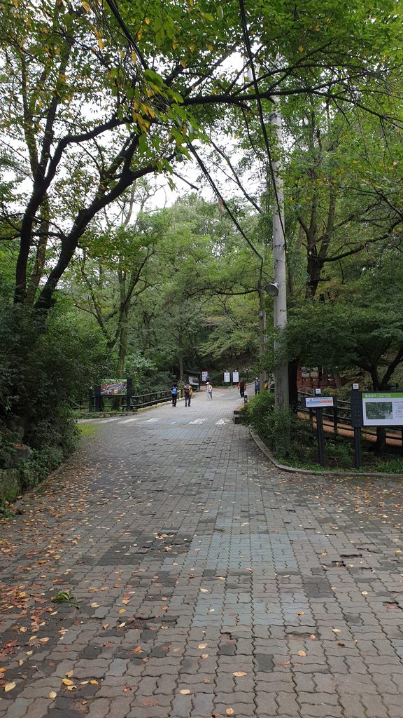
Past the Jeongneung Trail Support Center, a forest path leads up to Boguk-mun Gate. This stretch is fairly steep, so pacing yourself early on matters. Hiking in general tends to hit you hardest on that first steep climb since your breathing hasn’t settled in yet, but once you push through that initial burst, the rest gets noticeably easier. My advice is to take this first section slowly rather than trying to power through it.
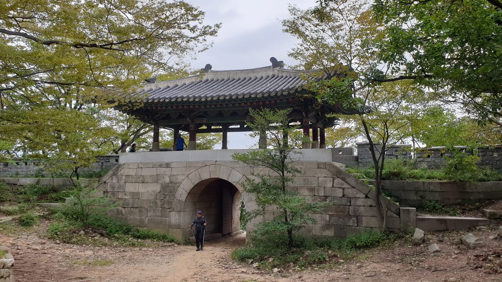
Once you pass Boguk-mun Gate, the ridge trail really begins. Along this ridge you’ll find sections of an old fortress wall built during the Joseon Dynasty to defend against foreign invasions, and the view of Seoul stretching out beyond that wall is genuinely striking.
Source : Seoul Metropolitan Government
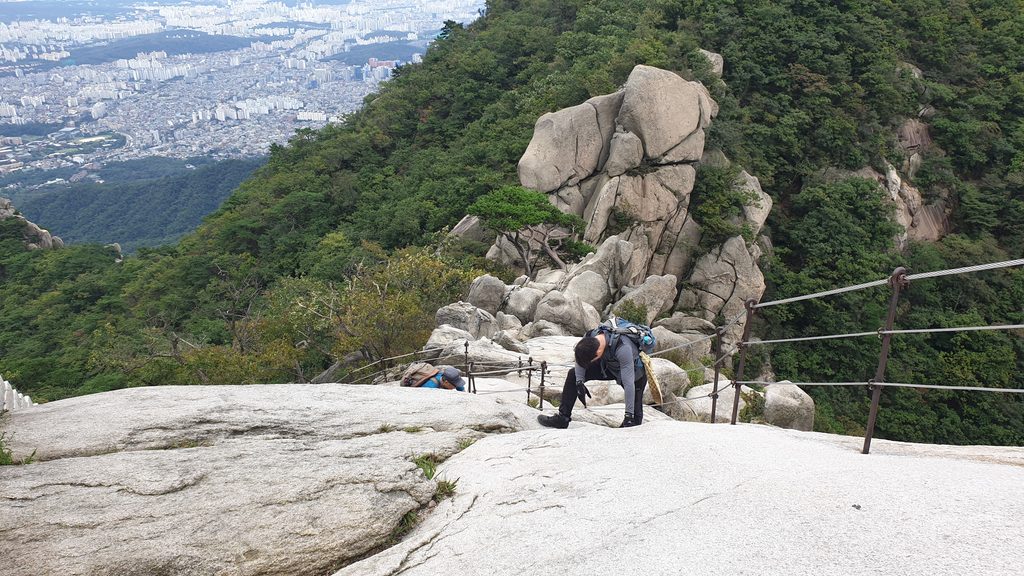
As you get closer to Baegundae, granite rock sections start to appear. Just before the summit, there’s a stretch where you need to pull yourself up using a fixed chain, and this is both the highlight of the course and its most nerve-wracking moment. Bring gloves for this part without fail. You’ll be gripping the chain and the metal safety barriers, and they can get slippery, so gloves are essential even in summer. In winter, this metal gets extremely cold, so leather gloves work better than cotton ones (cotton tends to be slippery when it matters).
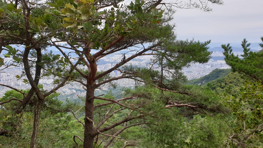
Once you reach the summit, you’re rewarded with an open panoramic view that takes in downtown Seoul, Dobongsan, and Insubong Peak. On a day with low fine dust levels, you can even see as far as the Han River and out toward the waters off Incheon.
The descent takes you down toward the Baegundae Trail Support Center on the Ui-dong/Doseonsa side, and this stretch offers a completely different set of views from the way up.
How to Get to the Trailhead
The most convenient way to reach Jeongneung Trail Support Center is by public transit. Get off at Jeongneung Station on the Ui Sinseol Line or Gireum Station on Line 4, then catch a local village bus heading toward Jeongneung from a nearby stop, which will take you close to the trail support center. Exact bus numbers and schedules can shift seasonally, so I’d recommend checking a map app in real time before you set out.
Source : Ui Sinseol Light Rail and Seoul Metro
At the descent point, Baegundae Trail Support Center, heading toward Ui-dong gives you access to both buses and taxis. Several bus routes pass through the area near the Ui-dong terminus, so getting back into central Seoul isn’t difficult. Since this course starts and ends at different points, it’s worth planning ahead of time whether you’ll take public transit back to your starting point or head straight to another destination after descending.
If you’re completely worn out by the time you reach Doseonsa, calling a taxi is also an option. Call taxis are able to drive right up to Doseonsa.
Bukhansan Difficulty Level
At 837 meters above sea level, Bukhansan doesn’t sound like a particularly tall mountain, but the difficulty you actually feel on the trail is noticeably higher than the elevation number suggests. The area around Baegundae’s summit in particular is made of granite bedrock, which makes for steep terrain that can get slippery after rain or snow, so extra caution is needed there. The fixed-chain section just before the summit can also get congested on weekends when hiker numbers spike. As mentioned above, make sure you bring gloves, ideally leather or the kind used on construction sites rather than a slippery material.
Source : Seoul Metropolitan Government
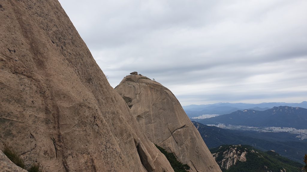
This particular course, running from Jeongneung Trail Support Center to Baegundae, is on the longer side compared to shorter routes that head straight up to the summit. If you’re not used to hiking, it’s a good idea to budget plenty of time overall and conserve your energy early on.
That said, it’s not so long that it becomes a real problem, and the ridge trail past Boguk-mun in particular is beautiful enough that I regularly recommend this course to friends.
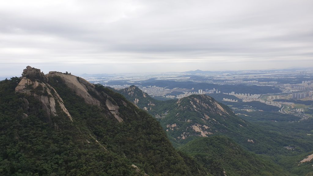
The descent toward Doseonsa also includes stretches of stairs and rocky path, so you’ll want to control your pace on the way down to avoid putting too much strain on your knees.
Where to Eat After Coming Down
For a good stop after your hike, I’d recommend Gaenari Sanjang. It sits right along the path as you come down the mountain, so it’s easy to reach, and it’s well known among hikers as a go-to spot after finishing a hike. Make sure to try the grilled deodeok (a Korean mountain herb root) there. The slightly bitter, fragrant flavor that’s distinctive to deodeok pairs really well with a body that’s tired from the climb.
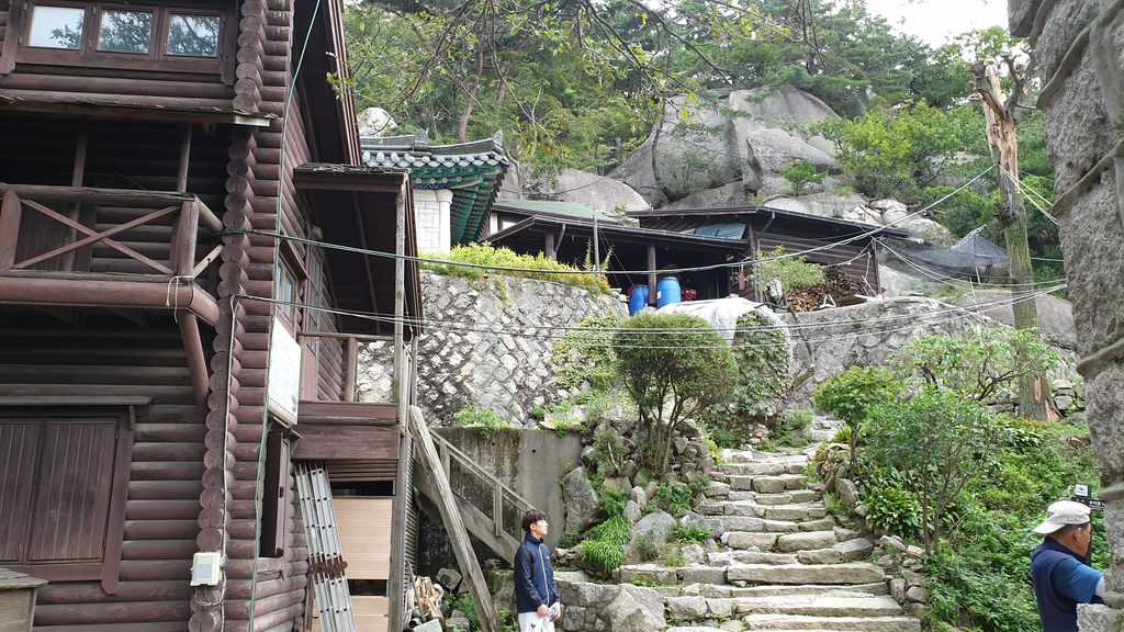
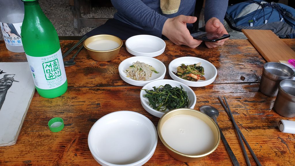
Grilled deodeok practically calls for makgeolli, and among Korea’s traditional fermented rice wines, I’d specifically recommend Seoul Jangsu Makgeolli. It has a smooth finish and a subtle sweetness, which makes it an easy entry point even for foreign visitors trying makgeolli for the first time. Enjoying a cold bowl of makgeolli alongside grilled deodeok after a hike is one of the small pleasures that’s practically built into Korean hiking culture.
Things to Watch Out for on Bukhansan
Because it’s so close to downtown Seoul, Bukhansan draws crowds of hikers on weekends. The fixed-chain section near Baegundae’s summit in particular tends to bottleneck, so I’d recommend building extra time into your schedule. If a weekday hike is an option for you, you’ll be able to enjoy the course in much more comfortable conditions.
While hiking, pay close attention to trail signs and markers as you move. In the rocky sections near the summit especially, staying on the designated trail matters a lot for safety. Wear hiking shoes with good grip, carry plenty of water in summer, and bring supplementary gear like crampons in winter. Also worth noting: there is nowhere along the trail to buy water, so make sure to pick some up at a convenience store before you start hiking.
As a rough guide, around 2 to 3 bottles of water per person should be enough for a summer hike. And since this is a national park, some sections may be closed depending on the season or weather conditions, so I’d recommend checking the latest closure information on the Bukhansan National Park website or at a visitor center before you go.
Source : Korea National Park Service
추천 글
Korea Mountain Hiking Guide : Taebaeksan’s Yuilsa Course
Korea Hiking Guide : Wolchulsan, Jeonnam Yeongam’s Sunrise Hotspot
Korea Mountain Hiking Guide : Geoje Mangsan
Best Korea Mountain for Fall Foliage : Sobaeksan Hiking Course and Local Food Guide